WDFW Beach Season Information
Clam, mussel, and oyster seasons OPEN for harvest year-round.
WDFW shellfish seasons indicate the specific times of year when harvesting is permitted. Before heading to the beach, please also check the Department of Health (DOH) information below which is related to health of the shellfish and may be updated daily. To harvest on this beach, it must be both during the WDFW approved season and approved by the DOH.
WDFW surveys indicate that native littleneck clams are present in fair numbers on East Indianola. Butter clams, Manila clams and cockles are also available.
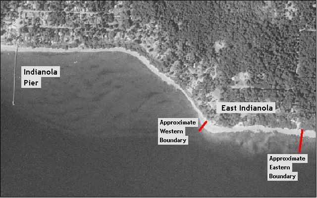
Recommended access to this beach is by boat. It is possible to access this beach on foot from the public beach access at the Indianola pier. It is about a half mile walk from the Indianola pier to East Indianola (see beach map).
Nearest boat ramps: The Suquamish boat ramp (located just off Suquamish Way in downtown Suquamish) is just under two miles by boat from east Indianola.
None. There are stores and other facilities in Suquamish a short distance from the boat ramp. Facilities for boaters are available at the Kingston Marina and the Brownsville Marina.